
GPS vehicle tracking for business fleets
Live locations, trip history and vehicle activity in one clear view.
GPS equipment installation and connection
Select an image to enlarge.
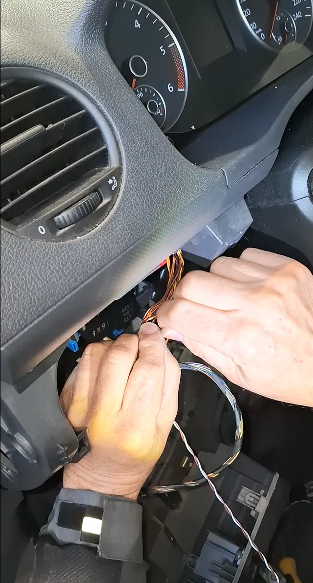
Know where your vehicles are
Check location and vehicle status through the web platform or mobile app. Review routes, stops and geofences without calling drivers for every update.
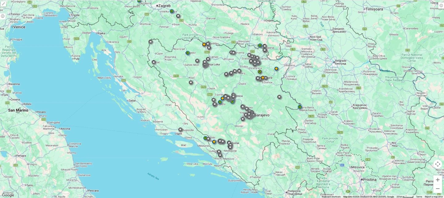
A configuration that fits your fleet
Available data depends on the vehicle, device and package. International use is subject to network coverage and the agreed service conditions.
Vehicle tracking that supports daily decisions
View vehicle locations, previous routes and stops through the web platform and mobile app. Tracking gives fleet managers a shared overview without calling drivers for every location update. Geofences and supported alerts help identify events worth checking. Data availability depends on satellite reception, mobile coverage and the installed equipment.
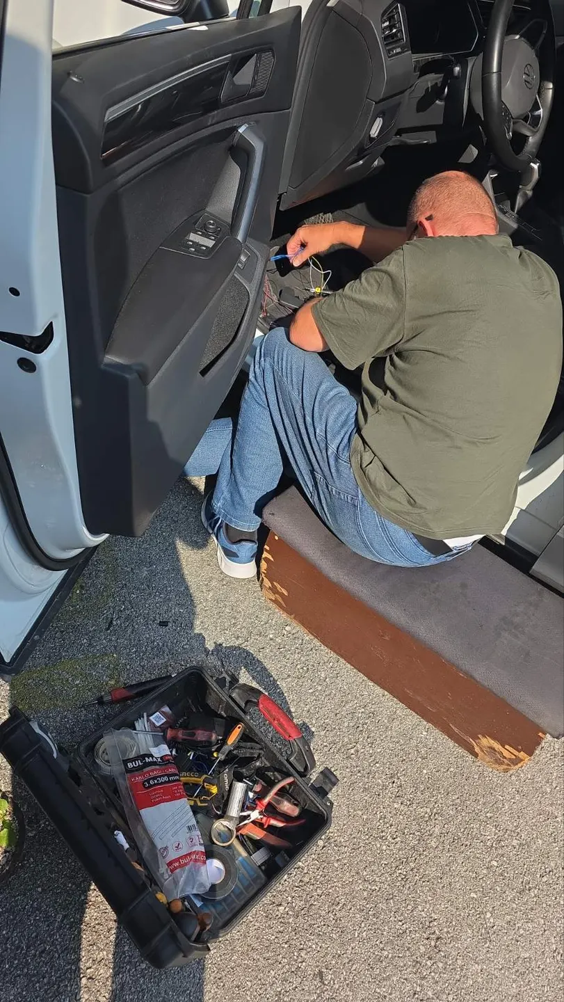
Choose the package for the data you need
Basic GPS includes rental equipment, tracking and history, Google services, speed compared with road limits, security and custom alerts, reports and driver scoring. It costs KM 10 per vehicle per month plus VAT. Advance GPS adds compatible CAN BUS vehicle data and fuel level and consumption monitoring for KM 13 plus VAT. Installation is KM 30 plus VAT for either package. Additional sensors are confirmed separately.
Installation and connectivity
Installation can be arranged at your location. We check vehicle type, required readings and access needs before fitting equipment. Domestic and roaming SIM cards have the same package price; the choice depends on your routes and confirmed network coverage. Access is available through a web platform and Android or iOS app. Tell us your fleet size, vehicle types and operating routes to receive a proposal.
How satellite vehicle tracking works
A GPS tracker determines the vehicle’s position using satellite signals. It sends data over the mobile network through a SIM card to the platform on your computer or phone. We select the device, installation and domestic or roaming SIM to suit your vehicles and routes. See fuel monitoring and GPS tracking packages for the corresponding options and costs.
Google Maps. More context for every journey.
Track vehicles on Google road or satellite maps, check traffic and review previous journeys in one system. From vehicle location to phone navigation, the information supports your daily work.
Included in the application price — no additional charge.
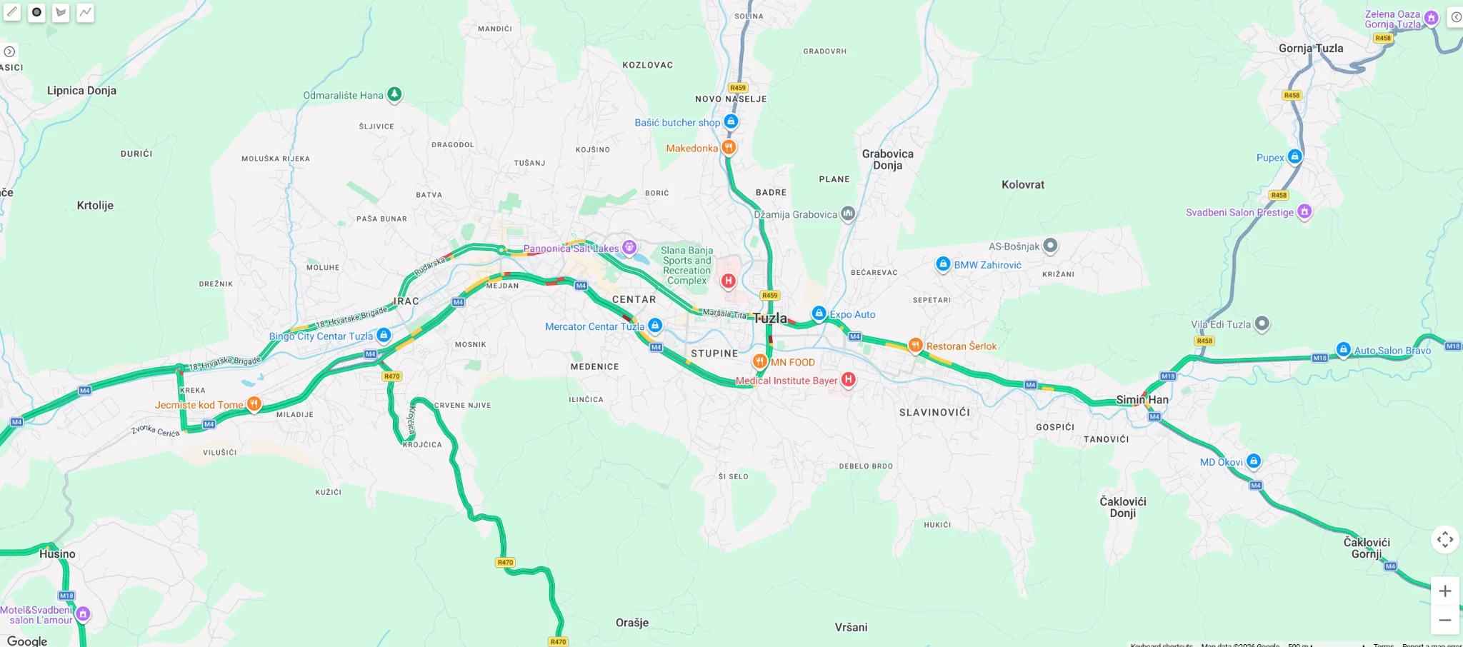
Traffic along your route
Enable Google Traffic to see colour-coded road segments. Dispatchers can assess congestion around their fleet and understand conditions along the route.
The example shows traffic in Tuzla without vehicle markers. This image is not a live traffic feed on this website.
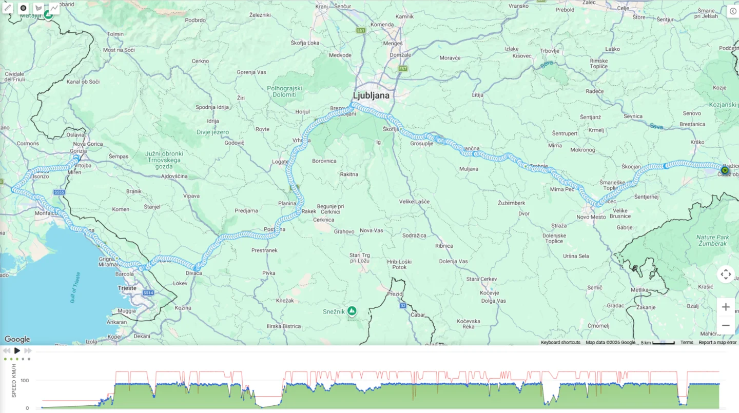
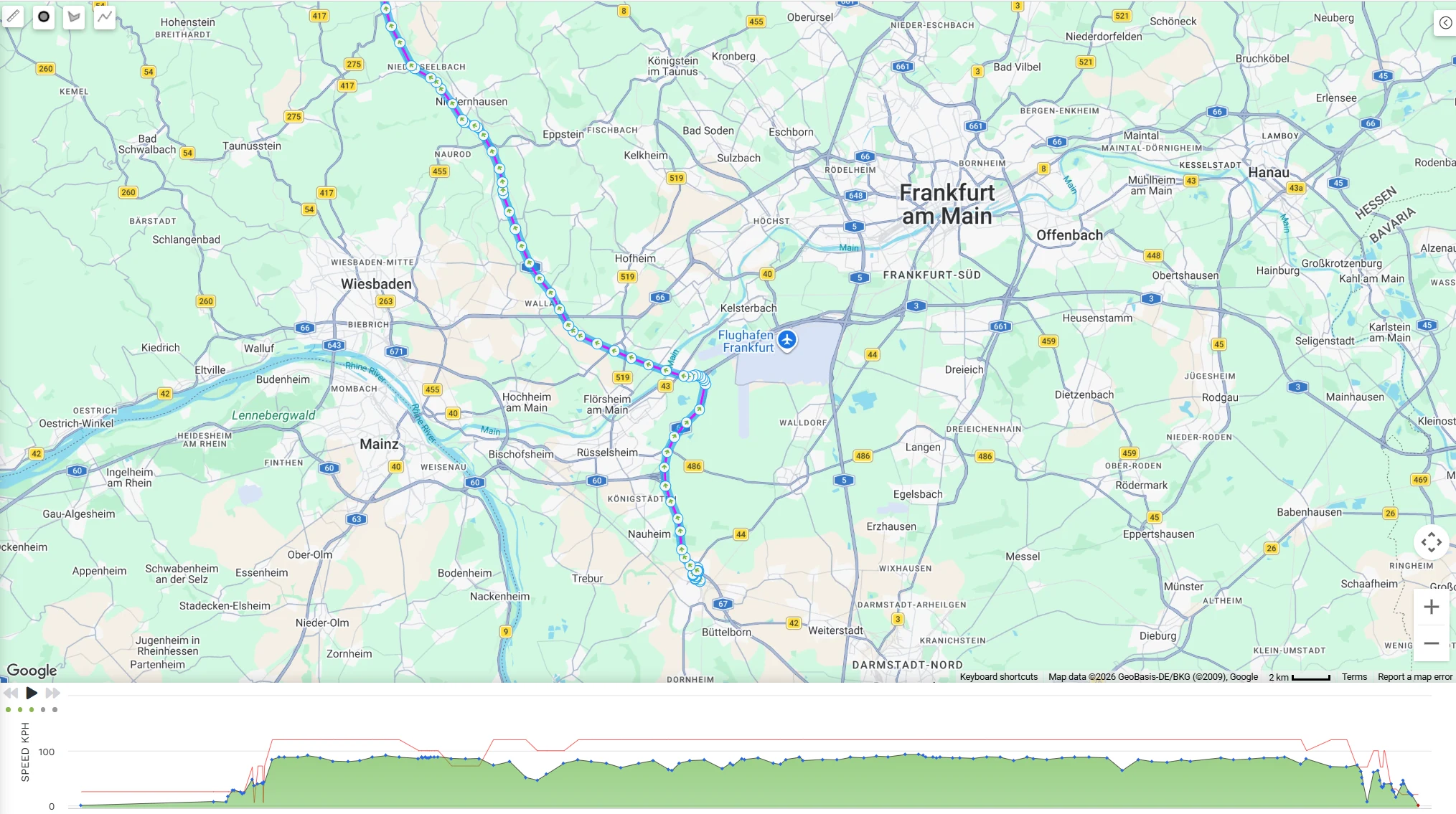
Vehicle speed compared with the road speed limit
Compare recorded vehicle speed with available Google road speed-limit data. In the chart the red line represents the road speed limit, while the green area with blue points represents vehicle speed.
Set a tolerance and minimum speeding duration, receive alerts and review events in reports. Road data supports analysis; drivers must follow actual road signs.
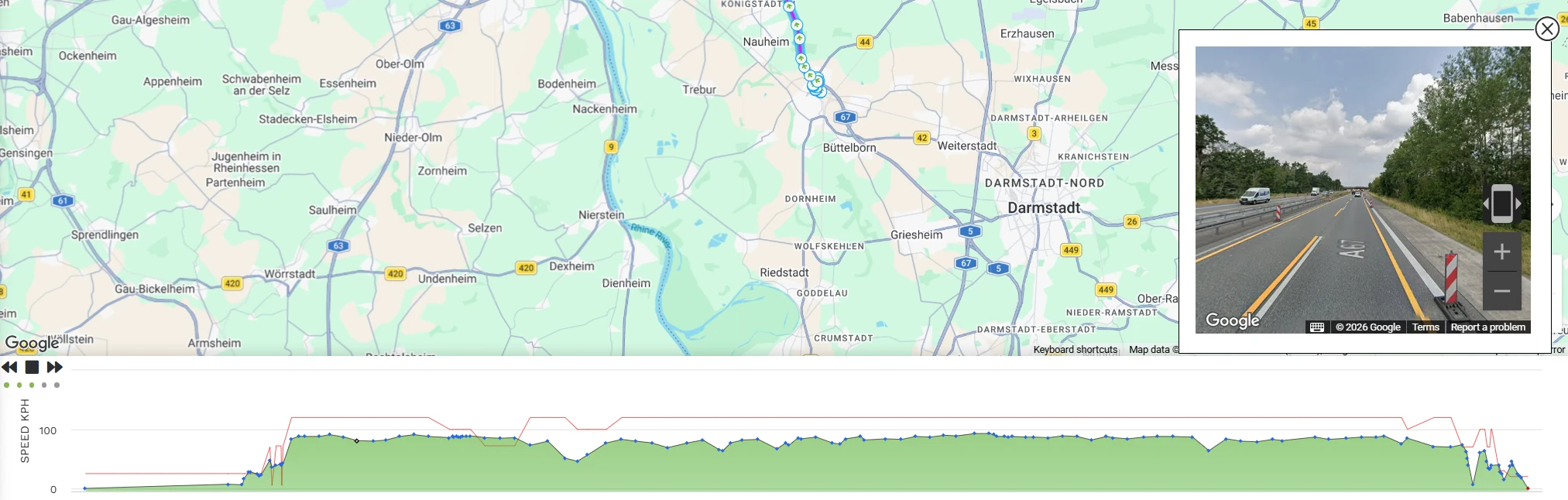
See the location from street level
Open Google Street View from a vehicle location or a point on a previous journey. View the surroundings alongside the map, journey playback and speed chart.
Available where Street View imagery exists. Street imagery is recorded footage, not a live feed or an in-vehicle camera.
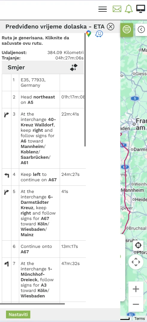
From location to navigation in one tap
Select a vehicle, address, coordinates, saved location or route. Review the calculated distance, estimated duration and turn instructions in the application.
On your phone, open the destination in Google Maps or Waze and continue navigation in your chosen application. Estimated travel time is indicative and may differ from the actual journey.
Availability and accuracy of traffic and road data vary by location. Street View shows previously captured imagery.
Request an application demonstrationQuestions before choosing a service
Why might a vehicle position stop updating?
Check the time of the last received reading and the vehicle status first. An unchanged marker may indicate a parked vehicle or the last known position while connectivity is unavailable. Interpret the reading with device status and journey history, not the map alone.
Does the GPS position also show whether the engine is on?
Position and ignition or engine status are different data points. Availability depends on the device and its vehicle connection. If engine operating time and idling matter to you, state this before quoting so we can check the appropriate configuration.
Can different vehicles use different packages?
Yes. A quote can reflect individual vehicle needs: one may require basic journey tracking, another compatible fuel readings or tachograph downloads. Functions, installation and monthly costs are stated according to the agreed configuration.
Request a quote
Tell us about your vehicles and required data. We confirm compatibility, equipment and costs, agree installation and prepare platform access.